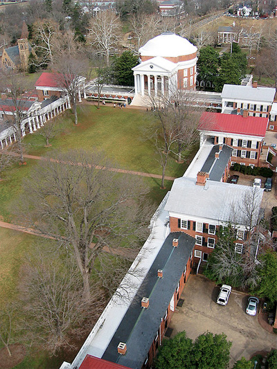
And as promised, a description of the second workshop offered at THATCampVA on Friday, April 20. Indicate your interest when you register for THATCampVA. From instructors Chris Gist and Kelly Johnston:
Need aerial images for a scholarly publication or research project and can’t find any that fit your needs? How about making your own? Grassroots mapping is an idea that allows people to survey and map what is important to them. People have surveyed oil spills, public demonstrations, small archaeological sites, etc. at a scale that fits their needs by dangling cameras from balloons and kites. They then use software to mosaic their aerial photographs into larger scenes that can be easily shared via Google Maps, Google Earth, or other digital mapping tools.
Come learn techniques to fly your own camera, make your own mosaics and go fly a kite (or balloon in this case)!
UPDATE: check out our post on the test flights!


Folks, I was visiting Artist in North Carolina long ago and still have at least one Jalbert kite that makes a good stable platform for a camera. I also have a pretty good library of kite books (ancient paper) that I’ll bring along. so, I opted for your workshop and plan to bring some stuff with me.
— geORge
@george & buddy @geoDuckie
By the way, I managed to find my 1987 instructions and plans for a simple trash bag sled kite. It would hold a very tiny camera. (grin)
ghbrett.org/?p=1489